Protecting our extensive range of flora and fauna
Conservation projects
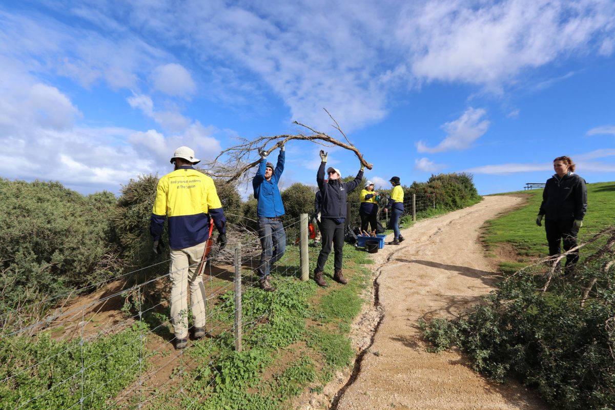
Great Ocean Road Coast’s conservation team actively conducts preventative and control methods along the coast to help protect and enhance the natural beauty of the Great Ocean Road coastline.
Native Vegetation and Weed Action Plan
This five-year action plan is the core of the conservation team’s ongoing work along the Crown land reserves. The Native Vegetation and Weed Action Plan helps guide the on-ground management to protect and enhance ecological values of the coastal environment.
- Native Vegetation and Weed Action Plan | 2015 – 2020
- Native Vegetation and Weed Action Plan Transect Monitoring Method
- Native Vegetation and Weed Action Plan Management Zone Recommendations
The conservation team implements long-term strategies and regularly monitors sites in accordance to this plan.
This program outlines key priority areas across for tackling weeds and protecting native vegetation along the Great Ocean Road Coast with annual reviews to ensure projects and conservation objectives remain on track.
Priority areas are:
- Weed removal
- Prevention of weed spread
- Vegetation quality
- Habitat areas for native fauna
- Presence of pest animals including foxes and rabbits
- Native wildlife protection
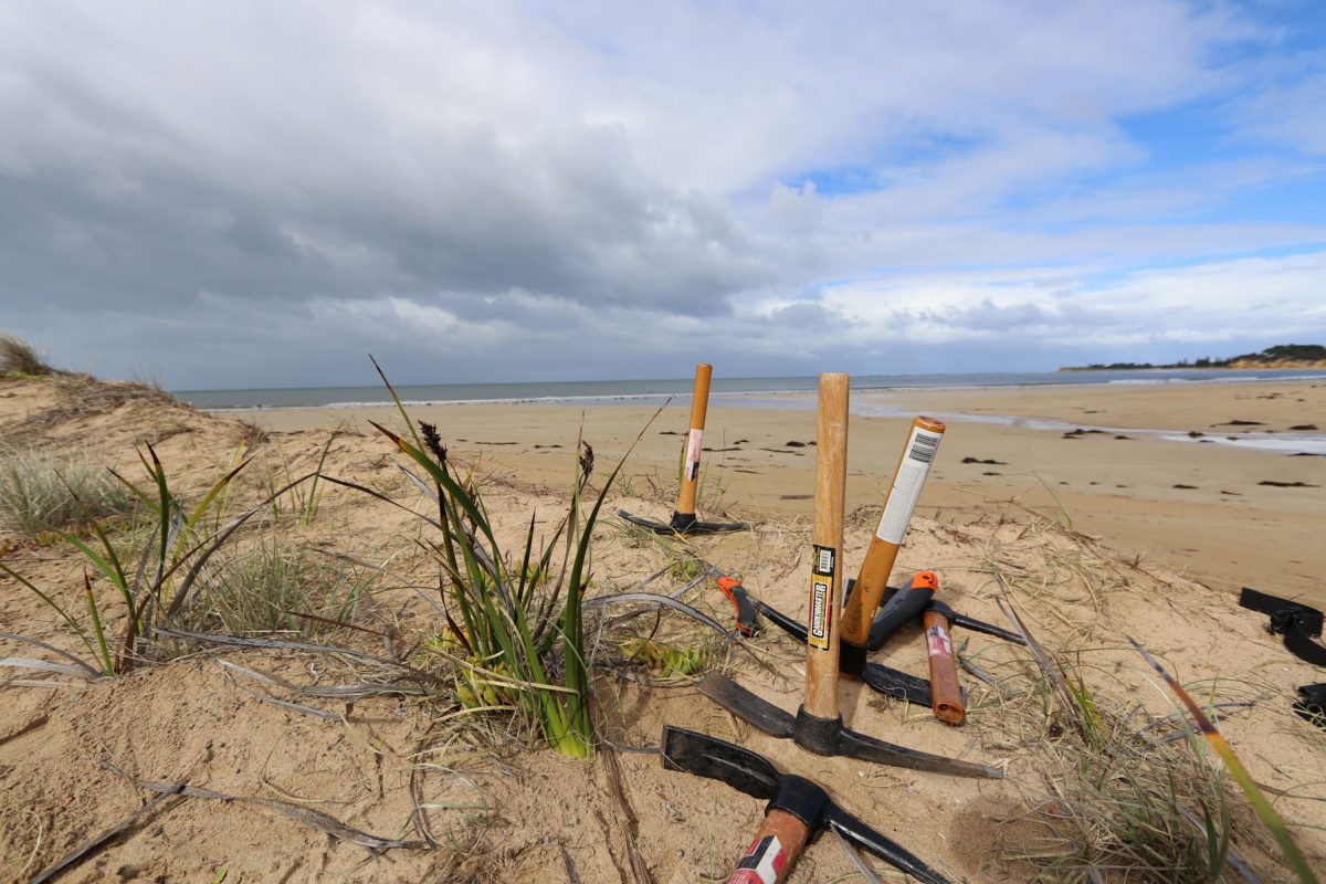
Vegetation monitoring
The conservation team regularly monitor the health and quality of the native vegetation along the coast with quarterly assessments in accordance to the Native Vegetation and Weed Action Plan.
To effectively monitor native vegetation, it is important to know the type of flora, the extent or presence and the overall condition of the vegetation. The conservation team monitors vegetation through a range of techniques with the most common method the use of a transect line.
This is a line, or rope that is place on the ground and the number of organisms or plants are observed and recorded at regular intervals along the transect. This provides a snapshot of the overall vegetation health in the area and an insight into the type of diversity present.
Motion sensing camera monitoring
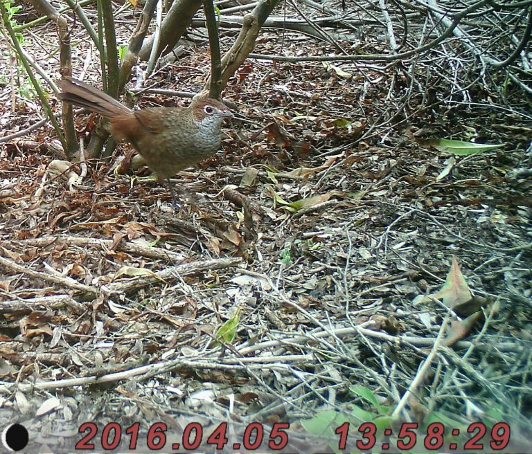
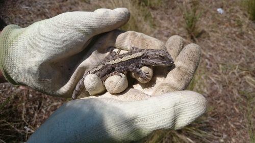
Since 2015, the Great Ocean Road Coast has been conducting wildlife monitoring through the use of motion sensing cameras. These cameras detect the movement of animals and captures a photo as they walk in front of the camera.
The team uses these cameras between Spring and Autumn to assess the presence of native and pest animals in the area. This helps to quantify the fauna in the area and allows the group to direct resources in the best strategic way.
In the past, the Great Ocean Road Coast’s main conservation task has primarily focused on weed removal and pest eradication. The motion sensing camera monitoring allows a visual representation of the revegetation works the team has been undertaking for years.
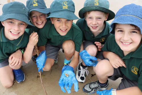
Hooded Plover monitoring
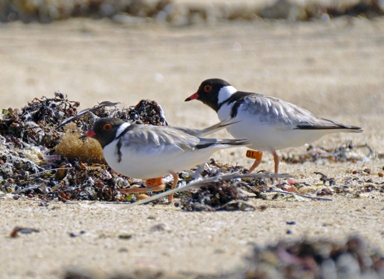 The hooded plover program is a critical program, not only raising awareness of the plight of a vulnerable beach-nesting shorebird, but also connecting people with broader issues of the ecosystems that sustain them.
The conservation team work alongside volunteers to monitor and track hooded plovers as they breed, putting up signs and fencing to help protect them from threats.
The team regularly patrol known breeding zones to ensure people obey signs, particularly in relation to dog laws.
Breeding season is usually between September and March and throughout this time, the team record data relating to the hoodies nests, eggs, chicks and fledglings to BirdLife Australia.
Learn more about hooded plovers here.
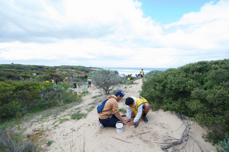
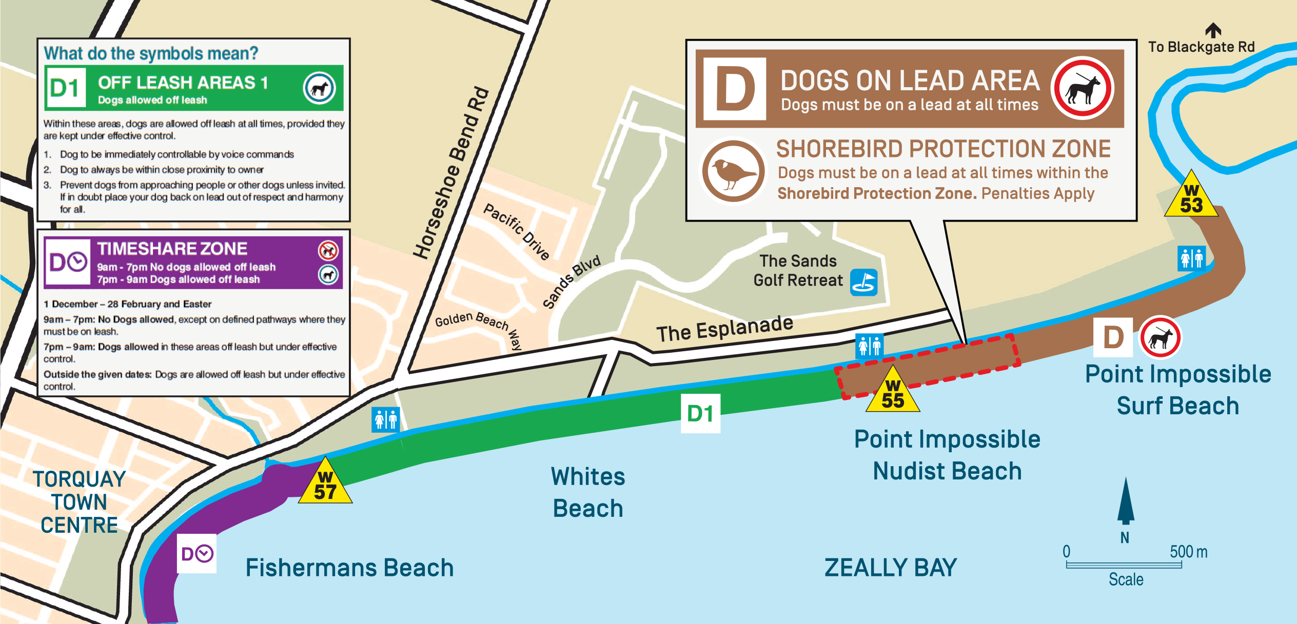
Point Impossible Shorebird Protection Zone
The Great Ocean Road Coast Committee, with support from Surf Coast Shire, has established an on-lead dog zone at Point Impossible to protect wildlife including shorebirds from the impacts of dogs off leash.
The results of this project will be incorporated in the Great Ocean Road Coast Committee’s Coastal Management Plan review in 2018 – 2019.
Map of protection zone at Point Impossible
To find out more follow this link.
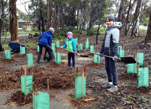
Coastal Tender Sites
The Corangamite Catchment Management Authority receives a large sum of money from the Victorian Government to deliver key projects through the Corangamite Conservation program.
The Coastal Tender program is designed for landholders like the Great Ocean Road Coast to make positive, lasting changes to the environment to ensure its resilience and diversity.
Land managers are required to meet a minimum standard for the commitments and actions they agree to as part of the coastal tender management plan.
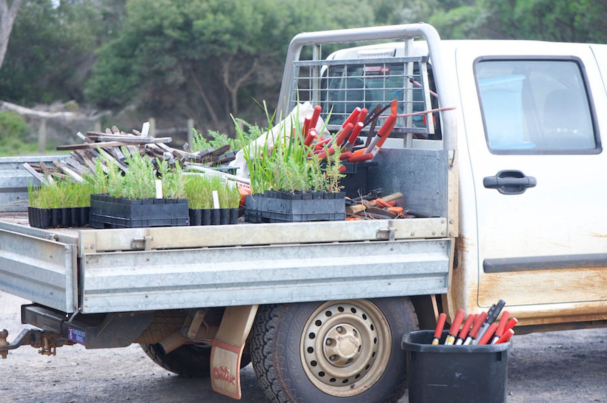
The Coastal Tender program focuses on native vegetation with management actions to improve the quality and extent of native vegetation at the given location.
Our current Coastal Tender sites include:
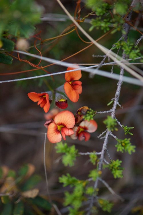
Point Roadknight dunes
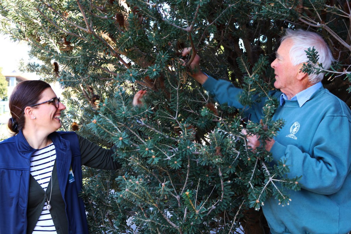
The project began in 2007 when local environmental volunteer group, ANGAIR realised the high conservation value of the area. They began works to restore the 11.5 hectares of Coastal Moonah Woodland from Point Roadknight to O’Donohues Road.
After the 1983 Ash Wednesday fires, much of the Moonah Woodlands were destroyed resulting in dense stands of Coast Tea Tree establishing. This Coastal Tender grant ensures only indigenous plants are planted in this area to re-establish the native vegetation without the use of fertiliser, or supplementary feeding for the health of the waterways.
This project has been a great educational tool for land managers, workers, corporate groups, schools and volunteers. More than 7,000 indigenous plants have already been returned to the area, often provided from the ANGAIR propagation centre.
More than 5,000 volunteer hours have gone into the restoration of the Point Roadknight dunes and has become one of the most successful habitats on the Great Ocean Road Coast managed land.
The CCMA Coastal Tender grant has help support ANGAIR’s work funding weed removal contactors and the purchase of tools and equipment.